Banff Icefields Parkway
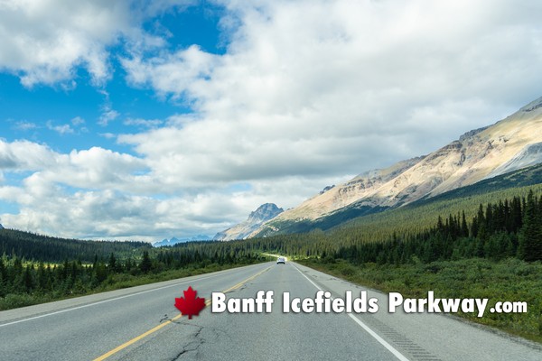
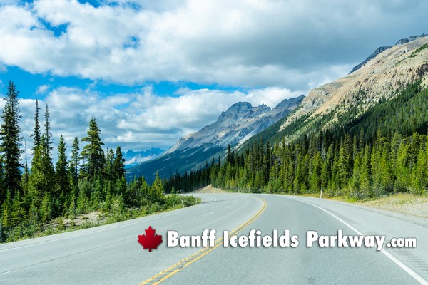
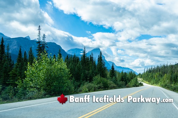
More from Banff to Jasper on the Icefields Parkway »The drive from Banff to Jasper along the Icefields Parkway unfolds as a continuous progression through some of the most dramatic alpine terrain in North America, where every segment of road feels intentionally carved through wilderness rather than built over it. Leaving Banff, the route begins with a gentle climb through dense montane forest, where lodgepole pine and spruce frame glimpses of distant peaks. The Bow River parallels the highway in stretches, its pale turquoise color hinting at glacial origins, while the valley gradually narrows and the mountains begin to close in with more imposing, jagged profiles.
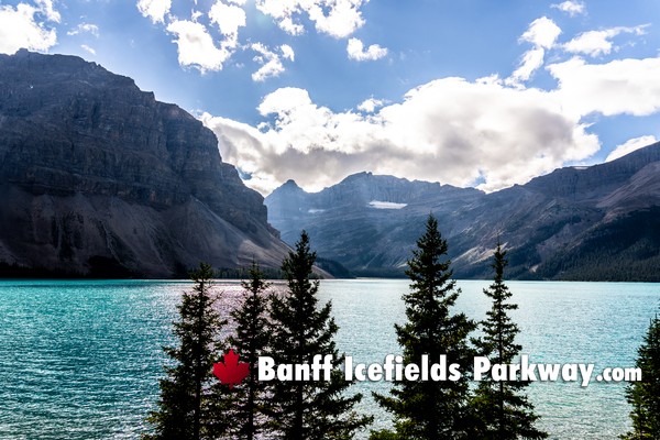
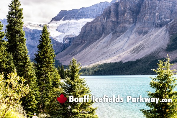
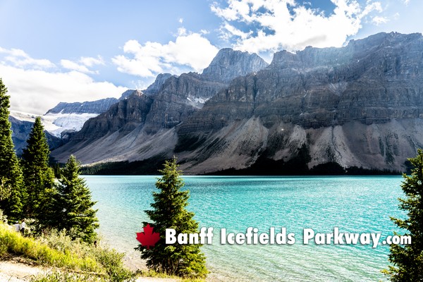
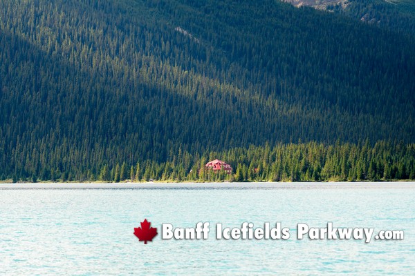
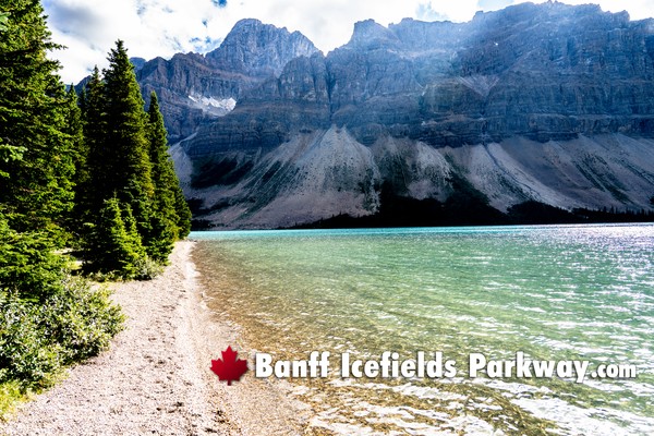
As the elevation increases, the landscape transitions into a more open subalpine environment. Wide valleys begin to appear, flanked by massive ranges with exposed rock faces and lingering snowfields even into summer. Bow Lake emerges as one of the first major visual anchors-a still, reflective body of water set beneath steep mountain walls, often mirroring the sky and peaks with striking clarity. Shortly beyond, Peyto Lake offers a dramatic shift in perspective, perched above the highway and revealing its iconic wolf-head shape and intense glacial blue color, created by suspended rock flour carried from upstream icefields.
Continuing north, the scale intensifies. The road begins to feel smaller against the expanding terrain, with towering summits rising abruptly from the roadside. The atmosphere becomes quieter and more remote, with fewer signs of development and long stretches where it's just the highway, the wind, and the mountains. Waterfalls cascade down cliff faces in multiple locations, especially in early summer when snowmelt is at its peak. Wildlife sightings become more common in these sections-bighorn sheep, elk, and occasionally bears-often grazing in roadside meadows or moving through the forest edge.
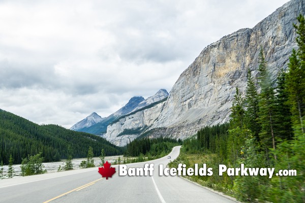
The approach to the Columbia Icefield marks a dramatic shift in both scenery and geological presence. Here, the mountains take on a heavier, more glaciated appearance, with broad expanses of ice visible from the highway. The Athabasca Glacier descends toward the valley floor, its ancient, slow-moving mass contrasting with the dynamic rivers that flow away from it. The air often feels cooler and sharper in this section, with winds sweeping down from the icefield and carrying a distinct alpine chill. The surrounding peaks appear more rugged and raw, shaped by centuries of glacial movement.
Beyond the icefield, the drive begins a gradual descent toward Jasper, but the scenery remains just as compelling. The highway traces along deep valleys and passes powerful water features like Sunwapta Falls and Athabasca Falls, where the river narrows and surges through carved limestone channels. The force of the water is evident in the sculpted rock formations and mist rising from below, offering a stark contrast to the stillness of earlier lakes along the route.
As you approach Jasper, the terrain softens slightly. The mountains remain large but become more rounded, and the forest thickens again with a mix of coniferous trees. The sense of remoteness gives way to a more settled feeling, though still deeply connected to wilderness. The road straightens in places, allowing longer sightlines into the valleys ahead, often with distant peaks layered in soft blue tones. By the time you reach Jasper, the journey feels less like a drive and more like a passage through evolving ecosystems, each section revealing a new expression of the Canadian Rockies shaped by elevation, ice, water, and time.
The Banff Icefields Parkway Drive
The Banff Icefields Parkway drive begins with a quiet sense of departure, as the road gradually leaves behind the energy of the Banff townsite and settles into a more immersive mountain environment. Almost immediately, the landscape starts to expand. Forested slopes rise on either side, and the Bow River threads alongside the highway, its milky turquoise color reflecting its glacial origins. The peaks ahead begin as distant silhouettes, but with each kilometer they grow sharper, more defined, and more imposing.As you move deeper into the parkway, the character of the drive becomes more dramatic and deliberate. The highway gently climbs, revealing wide valleys framed by towering mountain walls. Bow Lake appears as one of the first major visual moments-a calm, expansive lake surrounded by steep rock faces and lingering snowfields. Not long after, the elevation gain becomes more apparent as you approach Peyto Lake, where the viewpoint offers a striking overhead perspective of one of the most vividly colored lakes in the Rockies, shaped by glacial runoff and suspended sediment.
Further along, the Icefields Parkway begins to feel increasingly remote. The density of infrastructure fades, and long stretches of road unfold with uninterrupted wilderness. The mountains here are larger and more rugged, their faces etched with erosion lines and streaked with snow even in warmer months. Waterfalls begin to appear more frequently, especially during peak melt season, spilling down cliffs and feeding fast-moving rivers that cut through the valleys below. Wildlife often becomes part of the experience in this section, with animals occasionally visible along the roadside or in open meadows.
The most defining segment of the drive arrives at the Columbia Icefield. The scale shifts dramatically, with massive icefields spreading across the upper reaches of the mountains. The Athabasca Glacier becomes clearly visible from the road, descending slowly into the valley, its surface marked by deep crevasses and bands of compressed ice. The surrounding peaks feel colder and more exposed, shaped by centuries of glacial movement. Even from inside a vehicle, the air seems to change-crisper, thinner, and carrying a distinct alpine chill.
Beyond the icefield, the highway begins a gradual descent, but the intensity of the scenery continues. The Athabasca River gains momentum as it flows north, carving through rock and creating powerful features like Athabasca Falls, where the river compresses into a narrow canyon and surges with force. The surrounding terrain shows clear signs of erosion, with sculpted rock formations and channels shaped over time by relentless water flow.
As the drive continues toward Jasper, the environment subtly transitions once more. The mountains remain vast but take on slightly softer contours, and the forests become denser. The road straightens in places, offering long, uninterrupted views into distant valleys layered with peaks fading into blue. There is a noticeable shift from the stark, glaciated landscapes of the central parkway to a more forested and river-dominated environment.
Throughout the entire Banff Icefields Parkway drive, the experience is defined by constant visual change. It is not a single highlight but a sequence of evolving landscapes-glacial lakes, towering summits, icefields, waterfalls, and deep valleys-each revealing itself in rhythm with the road. The drive feels less like transportation and more like a continuous passage through one of the most geologically and visually dynamic regions in the Canadian Rockies.
Sights From Banff to Jasper along the Icefields Parkway
The sights along the Icefields Parkway from Banff to Jasper unfold in a structured sequence, each section defined by distinct geological features and visual character. The drive is best understood as a progression through landscapes shaped by water, ice, and elevation, rather than a collection of isolated stops.The opening stretch through the Bow Valley presents a broad, balanced landscape where river, forest, and mountain coexist in relatively gentle proportions. The Bow River runs alongside the highway, its pale turquoise color signaling glacial origins. Bow Lake emerges as an early focal point, set beneath steep peaks and often completely still, creating mirror-like reflections. Nearby, the Crowfoot Glacier clings to the mountainside, visible from the road and illustrating the slow retreat of ice over time.
As elevation increases, the scenery becomes more dramatic and elevated. Peyto Lake marks a major visual shift, viewed from above rather than at shoreline level. Its vivid blue color, caused by suspended glacial sediment, contrasts sharply with the surrounding dark rock and evergreen forest. This section of the parkway offers some of the highest viewpoints, where the scale of the surrounding mountain ranges becomes more apparent and layered ridgelines stretch into the distance.
Moving north toward Saskatchewan Crossing, the landscape opens significantly. Valleys widen, rivers braid and spread across gravel beds, and the spacing between mountain ranges increases. This area feels more remote and less defined by single viewpoints, emphasizing instead the sheer scale of the terrain. The confluence of major rivers here reinforces the sense of being in a central watershed, where water from glaciers begins long journeys outward.
The most visually dominant section arrives at the Columbia Icefield. Here, the presence of ice becomes central to the landscape. The Athabasca Glacier is clearly visible from the roadside, descending from a vast icefield that spans multiple mountain peaks. The terrain appears more rugged and exposed, with fewer trees and more raw rock surfaces shaped by glacial movement. The atmosphere often feels cooler and more austere, with wind sweeping down from the icefields.
Beyond this point, the parkway transitions into a series of powerful water features. Sunwapta Falls and Athabasca Falls showcase the force of glacial rivers as they compress through narrow channels and plunge over rock formations. The surrounding canyon walls and sculpted stone reveal ongoing erosion, with water actively reshaping the landscape. These stops contrast sharply with the still lakes earlier in the drive, emphasizing motion and energy rather than calm reflection.
Approaching Jasper, the environment begins to soften. Forests thicken again, and the mountains take on slightly more rounded forms. The Athabasca River continues to guide the route, but the valleys feel more enclosed and sheltered. Long sightlines open ahead, often framed by distant peaks fading into softer blue tones. The transition into Jasper is subtle but noticeable, marking a shift from stark, glacial dominance to a more forested and river-defined landscape.
Throughout the entire route, the sights are not isolated highlights but part of a continuous visual narrative. Lakes, glaciers, waterfalls, rivers, and mountain ranges appear in sequence, each shaped by the same underlying forces but expressed differently depending on elevation and terrain.
Icefields Parkway Driving Tips
Driving the Icefields Parkway requires a different mindset than a typical highway trip. This is a high-alpine, remote corridor where conditions, wildlife, and distance all play a role in how you plan and execute the drive. Approaching it with intention will significantly improve both safety and the overall experience.One of the most important considerations is fuel and services. There are very limited service points along the parkway, with only one main fuel stop at Saskatchewan Crossing. Distances between Banff and Jasper are long, and detours for viewpoints can add mileage quickly. It is best to start with a full tank and not rely on availability or operating hours once you are on the route.
Time management is critical. While the drive itself can technically be completed in a few hours without stopping, that approach defeats the purpose of the parkway. The route is designed for frequent pull-offs and short explorations. Plan for a full day at minimum, and ideally allow flexibility so you can stop whenever conditions or lighting make a location particularly compelling. Early morning or late afternoon driving often provides better light, fewer crowds, and more active wildlife.
Weather and road conditions can change rapidly due to elevation. Even in summer, temperatures can drop noticeably as you approach higher sections like Bow Summit or the Columbia Icefield. In shoulder seasons and winter, snow, ice, and strong winds are common. Checking conditions before departure is essential, and carrying extra layers is advisable regardless of the season. In colder months, winter tires are not optional-they are a necessity.
Wildlife awareness is a constant factor. Animals frequently move across or alongside the highway, especially during early morning and evening hours. Speed limits are enforced, but more importantly, they exist for safety. Sudden stops are common when wildlife appears, so maintaining safe following distances and staying alert is essential. Never approach or feed animals, even if others have stopped.
Driving pace should remain steady and controlled. The road is generally well maintained, but it includes long stretches without barriers, occasional sharp curves, and sections where weather can impact visibility. It is not a route for aggressive or rushed driving. Pullouts are frequent and should be used whenever you want to stop-never halt in the travel lane.
Preparation for limited connectivity is also important. Cell service is intermittent to nonexistent for much of the drive. Navigation should be preloaded or available offline, and any reservations or confirmations should be handled in advance. Emergency response times can be longer due to the remote nature of the parkway.
Pack essentials as if you will be self-sufficient for the day. Water, food, and basic supplies are important, especially if you plan to explore short trails or spend extended time at viewpoints. Weather shifts, delays due to wildlife, or extended stops can all lengthen the day beyond initial expectations.
Finally, treat the drive as an experience rather than a commute. The Icefields Parkway rewards patience. Slowing down, spacing out stops, and allowing the landscape to unfold naturally will give you a far better sense of the scale and variation of the Canadian Rockies than trying to check off locations quickly.
Seasonal Banff Icefields Parkway Considerations
Seasonality on the Icefields Parkway is not a minor variable-it fundamentally changes how the drive looks, feels, and functions. Each season reshapes visibility, access, safety conditions, and the overall pace of travel. Understanding these shifts is essential for planning effectively.Icefields Parkway in Winter (November to March)
Winter transforms the parkway into a quiet, high-alpine corridor defined by snow, ice, and reduced services. The road remains open, but conditions can be severe. Snowpack builds along the shoulders, narrowing visual margins, and black ice is common, especially in shaded sections and early morning hours. Storm systems can move in quickly, reducing visibility and creating whiteout conditions at higher elevations such as Bow Summit and near the Columbia Icefield.Traffic is minimal compared to summer, which creates a strong sense of isolation. This also means fewer immediate resources if something goes wrong. Winter tires are essential, not optional, and drivers should be prepared for cold starts, slower travel speeds, and longer braking distances. Many facilities, viewpoints, and secondary pullouts are closed or buried in snow, limiting where you can safely stop.
The visual experience is stark and powerful-frozen waterfalls, snow-covered peaks, and a subdued color palette-but it requires discipline and preparedness. Daylight hours are short, so timing becomes critical to avoid driving extended stretches in darkness.
Spring (April to early June)
Spring is a transitional and often unpredictable period along the parkway. Lower elevations begin to thaw, while higher elevations remain firmly in winter conditions. This creates a mix of wet pavement, lingering snowbanks, and potential icy patches in shaded areas. Freeze-thaw cycles can affect road surfaces and increase the risk of falling ice or small rock debris in certain sections. Water features become more dynamic as snowmelt begins. Early runoff feeds rivers and starts to awaken waterfalls, though peak flow typically arrives later. Lakes at higher elevations remain frozen or partially thawed, which can limit the classic turquoise lake views early in the season. Wildlife becomes more active during this time, often appearing near roadside vegetation as they emerge from winter conditions. Services begin to reopen gradually, but availability is inconsistent, so planning ahead remains important.Icefields Parkway During Summer (mid-June to September)
Summer is the most accessible and popular season, offering the widest range of viewpoints, open facilities, and stable driving conditions. Roads are typically clear, and all major stops-including lakes, waterfalls, and the Columbia Icefield area-are fully accessible. This is when glacial lakes reach their most vibrant turquoise color due to peak meltwater carrying suspended sediment.Traffic volume increases significantly, especially during July and August. Parking at major viewpoints can fill quickly, and pullouts can become congested. Early starts or later-day travel help mitigate this. Wildlife remains active, particularly in early morning and evening hours, and roadside encounters are common.
Weather is generally stable but still variable due to elevation. Sudden rain, temperature drops, or wind can occur, especially near the icefield. This is the best season for a full, uninterrupted experience of the parkway, but it requires patience with crowds and parking logistics.
Fall (late September to October)
Fall introduces a quieter, more atmospheric version of the parkway. Traffic drops noticeably after peak summer, and the landscape shifts in tone. Larch trees turn golden in select high-elevation areas, while lower elevations take on deeper greens and muted autumn colors. The air becomes cooler and crisper, and visibility is often excellent.Weather begins to reintroduce winter conditions, particularly at higher elevations. Snowfall can occur as early as late September, and icy conditions may return during mornings and evenings. Services begin to scale back or close for the season, and daylight hours shorten.
This season offers a balance between accessibility and solitude. The parkway feels less crowded, and the changing colors provide a different visual experience than summer, but flexibility is important due to variable conditions.
Overall Seasonal Banff Icefields Parkway Strategy
The Icefields Parkway is accessible year-round, but each season demands a different level of preparation. Summer offers ease and full access, winter requires maximum caution and self-sufficiency, and spring and fall operate as transitional periods where conditions can shift quickly between the two extremes. Matching your expectations, vehicle readiness, and timing to the season is the key factor in ensuring both safety and a high-quality experience along the route.
Photography Along the Banff Icefields Parkway
Photography along the Icefields Parkway is defined by timing, elevation, and understanding how light interacts with a constantly changing alpine landscape. The route offers a rare density of high-impact compositions-glacial lakes, towering peaks, waterfalls, and icefields-but capturing them well depends on precision rather than simply stopping at viewpoints.Light Direction and Time of Day
The orientation of the parkway means light behaves differently depending on your direction of travel. Driving from Banff to Jasper in the morning generally places the sun behind you for many east-facing valleys, giving cleaner, evenly lit scenes. In contrast, late afternoon and evening light from Jasper toward Banff produces warmer tones and stronger contrast on west-facing peaks.Early morning is the most reliable window for calm conditions. Lakes such as Bow Lake are often mirror-smooth at this time, allowing for strong reflection compositions. As the day progresses, wind typically increases, breaking reflections and flattening the visual impact. Golden hour-both sunrise and sunset-adds depth to mountain textures, highlighting ridgelines and creating long shadows that define the terrain.
Glacial Lakes and Color Capture along the Banff Icefields Parkway
The signature turquoise color of lakes like Peyto and Bow comes from suspended glacial sediment, and photographing that color accurately requires attention to light angle. Midday sun can intensify the blue, but it often flattens surrounding features. Slightly angled light-mid-morning or late afternoon-balances color saturation with texture in the mountains.Polarizing filters are useful here. They reduce glare on the water surface and deepen color contrast, but should be adjusted carefully to avoid uneven tones in wide-angle shots. Positioning is equally important-elevated viewpoints emphasize shape and color, while shoreline perspectives allow for foreground elements like rocks or driftwood to anchor the frame.
Mountain Scale and Composition
The Icefields Parkway presents a challenge of scale. Peaks are massive, and without foreground elements, images can feel flat or distant. Effective compositions often include layers-foreground (rocks, trees, water), midground (valley or lake), and background (mountain peaks).Using leading lines such as the curve of the road, river channels, or shoreline edges helps guide the viewer's eye into the frame. Wide-angle lenses are ideal for capturing the breadth of the scene, but they require careful framing to avoid making mountains appear smaller than they feel in person. Stepping back and including context often produces stronger results than zooming in too tightly.
Columbia Icefield and Glacier Photography
The Columbia Icefield introduces a different photographic environment-less color, more texture and scale. The Athabasca Glacier is best approached with a focus on patterns: crevasses, ice striations, and the contrast between white ice and dark surrounding rock.Lighting here is critical. Overcast conditions can actually improve glacier photography by softening harsh highlights and revealing surface detail. Bright midday sun can wash out texture and create strong glare. Including human-made elements such as vehicles or structures can help convey the immense scale of the icefield.
Waterfalls and Motion Control
Athabasca Falls and Sunwapta Falls offer opportunities to capture motion. The choice between freezing action or creating a smooth, flowing effect depends on shutter speed. Faster shutter speeds emphasize power and detail in the water, while slower exposures create a silky effect that contrasts with the rugged rock.Tripods become essential for longer exposures, especially in lower light conditions. Composition should consider both the main drop and surrounding rock formations, which often show erosion patterns that add visual interest beyond the water itself.
Icefields Parkway Wildlife Photography Considerations
Wildlife along the parkway is unpredictable but rewarding. Successful photography here relies more on readiness than location. Keeping a camera accessible, using a telephoto lens, and maintaining distance are all essential.Early morning and evening increase the likelihood of encounters. Positioning the vehicle safely off the road and shooting from a stable stance helps ensure both safety and image quality. Patience is key-wildlife images often come from waiting rather than chasing.
Weather and Atmospheric Conditions
Weather plays a major role in photographic outcomes. Clear skies provide visibility but can result in flat lighting. Partial cloud cover often produces the most dynamic images, adding depth and contrast to the sky and mountains. Storm systems can create dramatic scenes, with light breaking through clouds and illuminating sections of the landscape.Wildfire smoke, when present, reduces visibility but can also create softer, diffused light and muted tones. Adapting to conditions rather than resisting them often leads to more unique and compelling images.
Practical Shooting Strategy
Efficiency matters along the parkway. Parking areas can fill quickly, and light changes fast in mountain environments. Knowing your key stops in advance allows you to prioritize when conditions are optimal. Keeping gear organized and minimizing setup time helps capture fleeting moments, especially during sunrise or rapidly shifting weather.Photography along the Icefields Parkway is about reading the landscape in real time-watching how light moves, how weather evolves, and how each location reveals itself differently throughout the day. The most successful images come from combining preparation with adaptability, allowing the environment to guide when and where to shoot.
Wildlife Viewing Along the Banff Icefields Parkway
Wildlife viewing along the Icefields Parkway is one of the most compelling aspects of the drive, but it requires a deliberate, observant approach. This is not a controlled environment-animals move freely across vast terrain, and sightings are shaped by timing, habitat, and subtle behavioral patterns rather than guaranteed locations.Where Wildlife Is Most Commonly Seen along the Banff Icefields Parkway
The highest probability areas are valley bottoms, open meadows, and roadside vegetation where animals can access water and forage. Early sections near the Bow Valley often support elk and deer, while broader, quieter stretches closer to Saskatchewan Crossing and beyond tend to attract larger species due to reduced human activity. River corridors are particularly important, as they provide both food sources and natural travel routes.Edges are key. The transition zones between forest and open space-known as ecotones-are where animals frequently emerge. These areas offer both cover and visibility, making them ideal for grazing and movement. Long, straight sections of road that cut through these environments often provide the best opportunities to spot wildlife at a distance.
Best Times of Day
Wildlife activity follows predictable daily cycles. Early morning and late evening are the most active periods, when temperatures are cooler and human presence is lower. During these times, animals are more likely to be feeding or moving across open areas.Midday typically sees reduced activity, especially in summer, as animals retreat into shaded forested areas to avoid heat. However, this can vary with weather-overcast days often extend activity windows, increasing chances of sightings outside the typical peak times.
Seasonal Wildlife Behavior Patterns
Spring brings increased movement as animals emerge from winter and begin feeding heavily. This is also a time when you may see younger animals, though they are often kept closer to cover. Summer provides more consistent visibility, especially in early and late daylight hours, with animals grazing in open meadows.Fall introduces heightened activity due to mating seasons, particularly among elk. Behavior becomes more dynamic and sometimes more unpredictable. In winter, sightings become more concentrated in lower elevations where food is accessible, and animals conserve energy by limiting movement.
Common Species Along the Icefields Parkway
Large mammals are the primary draw. Elk are among the most frequently seen, often grazing near roadside clearings. Bighorn sheep tend to favor rocky slopes and can sometimes be spotted near steep roadside terrain. Black bears are present throughout the corridor, typically foraging near vegetation-rich areas, especially in spring and early summer. Grizzly bears inhabit more remote sections and are less commonly seen, but they do move through the region.Other species include deer, mountain goats in higher elevations, and occasionally wolves, though sightings of predators are rare and brief. Birdlife is also abundant, particularly near water sources.
Observation Techniques
Effective wildlife viewing is about scanning rather than searching aggressively. Slow your pace slightly through high-probability areas and use peripheral vision to detect movement. Look for subtle cues-color contrasts against vegetation, unusual shapes, or motion at the edge of your field of view.When one vehicle is stopped ahead, it can indicate a sighting, but approach cautiously and do not assume the road is clear. Use designated pullouts whenever possible rather than stopping abruptly.
Safety and Distance
Maintaining distance is critical-for both your safety and the animal's well-being. Animals that appear calm can react unpredictably, especially if they feel threatened or cornered. Staying inside your vehicle is often the safest option, particularly with larger animals.Never approach, feed, or attempt to attract wildlife. Not only is this dangerous, but it also disrupts natural behavior and can lead to long-term harm for the animals.
Photography and Viewing Etiquette
If you're photographing wildlife, use a telephoto lens rather than trying to get closer. This allows for detailed images while maintaining a safe buffer. Keep noise to a minimum and avoid sudden movements.Respect traffic flow. The Icefields Parkway is an active roadway, and unsafe stopping or crowding can create hazards. If a sighting draws multiple vehicles, ensure you are parked fully off the road and not blocking access.
Realistic Expectations
Wildlife viewing on the Icefields Parkway is not guaranteed, and that unpredictability is part of its authenticity. Some drives may offer multiple sightings, while others may be quieter. The key is to remain attentive throughout the journey, not just at designated stops.The experience is less about checking off species and more about observing how animals interact with this vast, interconnected landscape. When a sighting does happen, it feels natural and unscripted-an authentic moment within one of the most intact mountain ecosystems in North America.
One-Day vs Multi-Day Banff Icefields Parkway Itinerary
Planning the Icefields Parkway as a one-day versus multi-day experience fundamentally changes how you interact with the landscape. The route itself is the same, but pacing, depth, and flexibility are entirely different.One-Day Icefields Parkway Itinerary (Banff to Jasper – Efficient but Focused)
A one-day drive is achievable, but it requires disciplined pacing and selective stopping. The goal is to experience the major highlights without overextending time at any single location.Start early-ideally at sunrise-to maximize daylight and avoid early congestion. The first segment through the Bow Valley should be driven steadily, with an early stop at Bow Lake to take advantage of calm morning reflections. Continue upward to Peyto Lake, where a short walk to the viewpoint delivers one of the most iconic perspectives along the route.
From here, the pace becomes more strategic. Saskatchewan Crossing is typically a brief stop for fuel or a reset rather than a long visit. The central focus of the day shifts toward the Columbia Icefield, where the Athabasca Glacier becomes the most substantial stop. Depending on timing, this is where you allocate the longest break-either for a structured experience or a focused roadside exploration.
Continuing north, plan shorter stops at Sunwapta Falls and Athabasca Falls. These are high-impact, relatively quick-access locations that don't require extended hiking. As you approach Jasper, the drive becomes more continuous again, with fewer major stops and a gradual transition into forested terrain.
A one-day itinerary works best when you prioritize 5–7 key stops, maintain a steady flow, and avoid trying to do everything. Expect a full day-typically 10 to 12 hours including stops-with limited flexibility for extended exploration or unexpected delays.
Two-Day Icefields Parkway Itinerary (Balanced and Immersive)
A two-day approach significantly improves the experience by allowing the parkway to be divided into logical sections, reducing time pressure and increasing flexibility.Day one focuses on the southern half of the route. Depart Banff in the morning and take time at Bow Lake and Peyto Lake, allowing for longer stays and better photography conditions. Continue to Saskatchewan Crossing for a mid-day pause. Rather than pushing through, consider staying in the central parkway region. This positions you closer to the Columbia Icefield for early or late-day light, when conditions are often more dramatic and less crowded.
Day two centers on the Columbia Icefield and the northern section. With a closer starting point, you can experience the Athabasca Glacier earlier in the day, before peak activity. From there, continue north with unhurried stops at Sunwapta Falls and Athabasca Falls, allowing time to explore beyond the main viewpoints if desired.
This structure creates a more natural flow-day one emphasizes lakes and elevation gain, while day two focuses on glaciers and powerful river systems. It also allows for better adaptation to weather, as you can shift timing between days if conditions change.
Three-Day Icefields Parkway Itinerary (Deep Exploration)
A three-day itinerary transforms the drive into a fully immersive experience, where the parkway is no longer just a route but a destination in itself.Day one remains similar to the two-day plan but with even more flexibility. Spend extended time at Bow Lake, explore shoreline perspectives, and take advantage of quieter periods at Peyto Lake. You can incorporate short walks or secondary viewpoints that are typically skipped on tighter schedules.
Day two becomes centered entirely around the Columbia Icefield region. This allows for deeper exploration-multiple viewpoints, longer stops, and time to observe how light and weather interact with the glacier throughout the day. You can also explore nearby short trails or simply take time to absorb the scale of the environment without feeling rushed.
Day three focuses on the northern section toward Jasper. With minimal time pressure, you can fully experience Sunwapta Falls and Athabasca Falls, explore surrounding paths, and enjoy the gradual transition into Jasper National Park. This pacing allows for spontaneous stops, wildlife observation, and extended photography opportunities.
Key Differences in Experience
The one-day drive emphasizes efficiency and highlights. It delivers a strong visual experience but limits depth and flexibility. The two-day option introduces balance, allowing for better timing and a more relaxed pace. The three-day approach provides the highest level of immersion, where the journey becomes exploratory rather than structured.Strategic Icefields Parkway Itinerary Considerations
Longer itineraries allow you to work with the environment rather than against it. Weather, light, and wildlife activity rarely align perfectly with a fixed schedule. Multi-day plans give you the ability to adjust-waiting for clouds to clear, revisiting locations under different light, or extending time at unexpectedly compelling stops.In contrast, a one-day itinerary requires commitment to forward movement. Delays-whether from traffic, weather, or wildlife-can compress the schedule quickly, making prioritization essential.
The choice between one-day and multi-day comes down to intent. If the goal is to see the Icefields Parkway, one day is sufficient. If the goal is to experience it-understand its scale, variation, and rhythm-then extending the timeline changes the drive from a checklist into a layered, memorable journey.
Short Walks and Easy Trails Along the Banff Icefields Parkway
Short walks and easy trails along the Icefields Parkway are one of the most effective ways to experience the landscape without committing to long hikes. Many of the best views are only a few minutes from the road, but they still deliver high-impact scenery-glacial lakes, waterfalls, and elevated viewpoints.Bow Lake Shoreline Walk
This is one of the easiest and most rewarding stops early in the drive. From the parking area, a flat path leads directly to the lakeshore within minutes. The terrain is wide and open, with minimal elevation gain, making it accessible for most visitors. Walking along the shoreline provides changing perspectives of the lake and surrounding peaks, especially in calm morning conditions when reflections are strongest. The further you walk, the quieter it becomes, with fewer people and more uninterrupted views.Peyto Lake Viewpoint Walk
The walk to the Peyto Lake viewpoint is short but slightly uphill. The path is well-defined and typically takes around 10–15 minutes from the parking area. The reward is immediate-a high-elevation overlook of one of the most vividly colored lakes in the Rockies. The trail is wide and maintained, making it accessible for a broad range of visitors. Additional short paths near the viewpoint allow for slightly different angles without adding significant distance.Waterfowl Lakes Pullouts
While not a formal trail system, this area offers multiple informal short walks from roadside pullouts. The terrain is mostly flat, allowing you to step out and explore lakeside edges or riverbanks without committing to a structured hike. These stops are ideal for quick exploration, photography, and stretching your legs while still experiencing the scale of the surrounding mountains.Mistaya Canyon Walk
This is a short but slightly more involved walk compared to the lakes. The trail descends gradually through forest toward a narrow canyon carved by rushing water. The distance is relatively short, but there are some uneven sections and a mild incline on the return. At the canyon, you can view powerful water flow cutting through sculpted rock, offering a very different landscape from the open lakes and valleys along the parkway.Columbia Icefield Viewpoints
Near the Columbia Icefield, several short walks lead to viewpoints overlooking the Athabasca Glacier. These are generally flat or gently sloped and require minimal time. The focus here is on scale-standing close enough to observe the glacier's surface, surrounding peaks, and the raw, exposed terrain shaped by ice. Even brief stops here provide a strong sense of the environment.Sunwapta Falls Walk
A short, well-defined path leads from the parking area to the main viewpoint of Sunwapta Falls. The walk is only a few minutes and mostly flat. From the viewing area, you can see the river split around a small island before dropping into a narrow gorge. Additional short paths extend slightly beyond the main viewpoint for different angles, but the primary experience requires very little walking.Athabasca Falls Walkways
Athabasca Falls features a network of short, interconnected paths and viewpoints. The main viewing areas are only a short walk from the parking lot, with paved or well-maintained trails. You can move between multiple overlooks in a short amount of time, each offering a different perspective of the powerful water flow and carved rock formations. The terrain is easy to navigate, though care is required near edges due to strong currents and slippery surfaces.Tangle Creek Falls (Roadside Stop)
This is one of the most accessible stops along the parkway. The waterfall is directly visible from the roadside, and you can step out of your vehicle and walk a very short distance to get closer. There is no formal trail required, making it an ideal quick stop with minimal effort.Parker Ridge (Moderate but Short)
While slightly more demanding than others listed, Parker Ridge is still relatively short and worth noting. The trail climbs steadily but is not long, and the payoff is a sweeping view of a glacial valley and the Saskatchewan Glacier. It requires more effort than a casual walk but remains manageable for many visitors looking for a slightly elevated experience without a full hike.Overall Icefields Parkway Stopping Strategy
Short walks along the Icefields Parkway are about efficiency and variety. Many stops require less than 30 minutes but provide completely different perspectives-lakes, canyons, waterfalls, and glaciers. The key is to combine several of these stops throughout the drive rather than relying on a single long hike.Spacing them out also helps maintain energy and keeps the experience dynamic. Instead of one extended outing, you move through multiple environments, each offering a distinct view of how water, elevation, and ice shape the landscape.
Best Longer Icefields Parkway Exploration Areas
Longer exploration areas along the Icefields Parkway are where the experience shifts from roadside sightseeing into immersive alpine travel. These zones allow you to move beyond viewpoints and step into the structure of the landscape-glacial valleys, high ridgelines, and remote lake systems. Each area offers a different type of terrain and a deeper sense of scale.Parker Ridge & Saskatchewan Glacier Overlook
This is one of the most efficient “longer” hikes in terms of effort versus reward. The trail climbs steadily above treeline, transitioning quickly from forest into open alpine terrain. As you gain elevation, the surrounding peaks expand outward, and the landscape opens dramatically.At the ridge, the Saskatchewan Glacier comes into full view, stretching deep into a broad valley. The perspective here is elevated and unobstructed, allowing you to see the glacier's flow path and surrounding mountain structure. Wind exposure is common at the top, and conditions can shift quickly, but the vantage point is one of the most expansive along the parkway.
Wilcox Pass & Athabasca Glacier Views
Wilcox Pass offers a longer and more varied alpine experience. The trail begins near the Columbia Icefield and climbs gradually into a wide, open pass above the valley. Unlike more confined hikes, this route feels expansive, with rolling terrain and long sightlines.From higher sections of the pass, the Athabasca Glacier is visible from a distance, providing a broader context than the roadside viewpoints. This area is also known for wildlife presence, particularly in open alpine zones. The terrain encourages exploration beyond a single viewpoint, with multiple areas to stop and observe the surrounding peaks and valleys.
Bow Glacier Falls (Bow Lake Area)
This route starts at Bow Lake and follows a relatively gentle path along the lakeshore before continuing into a glacial valley. The hike gradually leads you deeper into the landscape, with the lake behind you and towering peaks ahead.The destination is Bow Glacier Falls, where water descends from a hanging glacier above. The approach allows you to experience multiple layers of the environment-shoreline, open valley, and glacier-fed waterfall. The terrain is not highly technical, but the distance makes it a more committed outing compared to shorter walks.
Helen Lake & Cirque Peak Area
This is one of the more visually diverse longer hikes along the parkway. The trail climbs steadily through forest before opening into a high alpine meadow filled with wildflowers in summer. The environment shifts quickly from enclosed to expansive as you gain elevation.Helen Lake itself sits in a broad alpine basin, surrounded by peaks and open sky. For those continuing higher, Cirque Peak offers even more dramatic elevation gain and panoramic views. This area provides strong seasonal variation, with vibrant summer colors and early snow possible in shoulder seasons.
Stanley Falls & Valley Exploration (Lower Elevation Option)
For a less exposed but still longer exploration, valley-based trails like those leading to Stanley Falls provide a quieter experience. These routes remain mostly within forested environments, following rivers and moving through shaded terrain.While they lack the high alpine views of other hikes, they offer a different perspective-closer to water systems, with more intimate surroundings and fewer crowds. These are good options when weather at higher elevations is unstable or when a more sheltered hike is preferred.
Sunwapta River & Backcountry Extensions
Near Sunwapta Falls, there are opportunities to extend beyond the main viewing areas into longer, less-traveled routes. Following the river corridor allows for deeper exploration into the surrounding terrain, where the sound and movement of water remain a constant presence.These areas begin to transition toward backcountry-style experiences, where navigation, preparation, and awareness become more important. The reward is increased solitude and a stronger sense of remoteness compared to roadside stops.
Overall Exploration Strategy
Longer exploration areas along the Icefields Parkway are best approached with a clear understanding of elevation, weather exposure, and time commitment. Many of these hikes move quickly into alpine zones where conditions can change rapidly, even in summer.Spacing these experiences across a multi-day itinerary is often more effective than attempting multiple long hikes in a single day. Each area offers a distinct environment-glacier views, alpine meadows, valley systems-and combining them thoughtfully creates a more complete understanding of the region.
These longer routes transform the parkway from a scenic drive into an active exploration of the Canadian Rockies, where the landscape is no longer observed from a distance but experienced directly within it.
Tours and Attractions in Alberta
Best Tours in Banff National Park »Best Tours in Jasper National Park »
Best Tours in Lake Louise »
Hikes in Banff National Park »
Hikes in Jasper National Park »
Best Hikes in Lake Louise »
Banff Gondola »
Maligne Lake Boat Cruise »
Banff Gondola Deck Views »
Gondola Educational and Interpretive Areas »
Columbia Icefield Ice Odyssey »
Gondola Gift Shops »
Banff Patio Views »
Gondola Sky Bistro »
Spring, Summer and Fall Banff Gondola Ride Admission »
Gondola Starbucks »
Sulphur Mountain Boardwalk »
Banff Gondola Tickets »
Northern Lights Alpine Kitchen »
Above Banff Shop »
Top of the Banff Gondola »
Banff Gondola Winter Nightrise Experience »
Bow Falls »
Lake Louise »
Moraine Lake »
Banff Lake Louise Gondola Lodge »
Peyto Lake »
Lake Louise Gondola Lodge Coffee and Deli »
Banff Lake Louise Gondola Lodge Kuma Yama Dining »
Bridal Veil Falls »
Banff Lake Louise Gondola Lodge Recreation Area »
The Lake Louise Gondola Lodge Ride »
Cascade Ponds & Bow Valley Parkway »
Banff Lake Louise Gondola Summer Open Air Chairlift »
Banff Icefields Parkway »
Banff Lake Louise Gondolas on Whitehorn Mountain »
Lake Minnewanka »
Banff Lake Louise Summer Grizzly Express Gondola »
Sulphur Mountain & Banff Gondola »
Tunnel Mountain »
Banff Park Museum »
Banff Upper Hot Springs »
Cave & Basin National Historic Site »
Johnston Canyon »
Mt. Norquay »
Sunshine Village »
Icefields Parkway »
Bow Valley Parkway »
Bankhead Ghost Town »
Cascade Ponds »
Cave and Basin Marsh Loop »
Fenland Trail »
Healy Pass »
Hoodoos Trail »
Johnston Lake »
Silverton Falls »
Upper Stoney Lookout »
Vermilion Lakes Drive »
Lake Minnewanka Viewpoints »
Norquay Green Spot Viewpoint »
Sulphur Mountain Summit Boardwalk »
Tunnel Mountain Summit »
Vermilion Lakes Scenic Drive »
Bow Falls Viewpoint »
Cascade Gardens Mountain Viewpoint »
Hoodoos Viewpoint »
Johnston Canyon Upper Falls »
Mount Edith Pass »
Surprise Corner Viewpoint »
Upper Stoney Lookout »
Athabasca Falls & Sunwapta Falls »
Athabasca Glacier & Jasper Columbia Icefield »
Athabasca Falls »
Dark Sky Preserve & Northern Lights »
Jasper SkyTram Up Whistlers Mountain »
Maligne Canyon »
Maligne Lake & Spirit Island »
Medicine Lake »
Miette Hot Springs »
Mount Edith Cavell & Cavell Meadows »
Pyramid Lake »
Skyline Trail »
Whitewater Rafting on the Athabasca River »
Hike Jasper | Tour Canadian Rockies | Jasper Columbia Icefield | Maligne Lake Boat Cruise | Jasper Wildlife | Book Banff National Park | Book Jasper National Park | Banff Gondola | Lake Minnewanka Boat Cruise | Athabasca River Rafting | Jasper Wildlife Tours| Rocky Mountain Train Tickets | Maligne Ice Walk | Shopping Jasper | Columbia Icefields Glacier Skywalk | Jasper SkyTram | Jasper Maligne Lake Cruise | Johnston Canyon | Golden Skybridge | Banff Boat Cruise | Tour Moraine Lake